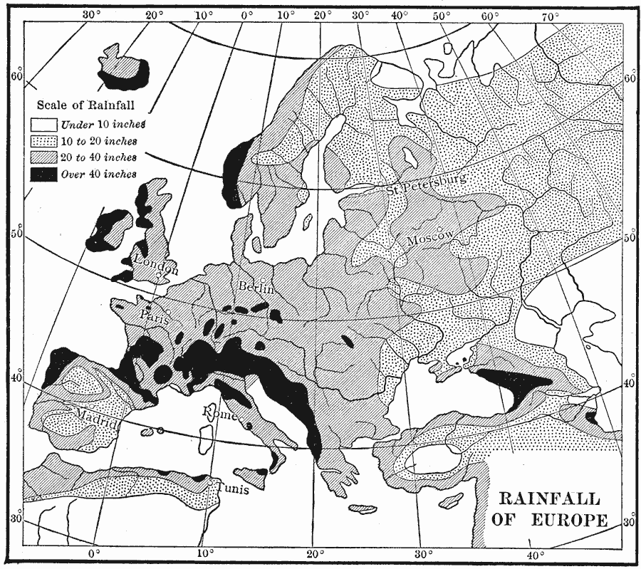
Description: A precipitation map of Europe showing the averaged annual rainfall of the region measured in inches, and showing areal measurements ranging from under 10 inches to over 40 inches of rainfall per year.
Place Names: A Complete Map of Europe, France, �Germany, �Greece, �Italy, �Poland, �Portugal, �Romania, �Spain, �Sweden, �United Kingdo
ISO Topic Categories: oceans,
location,
inlandWaters
Keywords: Rainfall Map of Europe, meteorological, kClimate, rainfall, oceans,
location,
inlandWaters, Unknown, 1910
Source: Ralph S. Tarr, B.S., F.G.S.A. and Frank M. McMurry, Ph.D., New Geographies (Second Book) (New York , NY: The MacMillan Company, 1910) 262
Map Credit: Courtesy the private collection of Roy Winkelman |
|