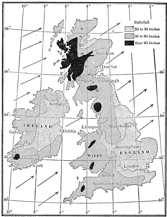
Description: A precipitation map of the British Isles showing the averaged annual rainfall of the region measured in inches, showing areal measurements ranging from 20 inches to over 60 inches of rainfall per year, and the general wind direction off the Atlantic, which effects precipitation.
Place Names: United Kingdom, England, �Ireland, �Scotland, �Wale
ISO Topic Categories: oceans,
location,
inlandWaters
Keywords: Rainfall of British Isles, meteorological, kClimate, rainfall, oceans,
location,
inlandWaters, Unknown, 1910
Source: Ralph S. Tarr, B.S., F.G.S.A. and Frank M. McMurry, Ph.D., New Geographies (Second Book) (New York , NY: The MacMillan Company, 1910) 264
Map Credit: Courtesy the private collection of Roy Winkelman |
|