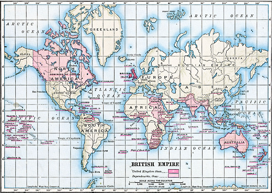
Description: A map of the world from 1910 showing the United Kingdom and its possessions and dependencies. The map is color–coded to show British Empire at the time, including Canada, Australia, India, territories in Africa, Indonesia, and the Americas, as well as its island possessions.
Place Names: A Complete Map of Globes and Multi-continent, Africa, �Antarctica, �Asia, �Australia, �Europe, �North America, �Pacific Ocean, �South Americ
ISO Topic Categories: oceans,
location,
inlandWaters
Keywords: British Empire, political, major political subdivisions, oceans,
location,
inlandWaters, Unknown, 1910
Source: Ralph S. Tarr, B.S., F.G.S.A. and Frank M. McMurry, Ph.D., New Geographies (Second Book) (New York , NY: The MacMillan Company, 1910) 274
Map Credit: Courtesy the private collection of Roy Winkelman |
|