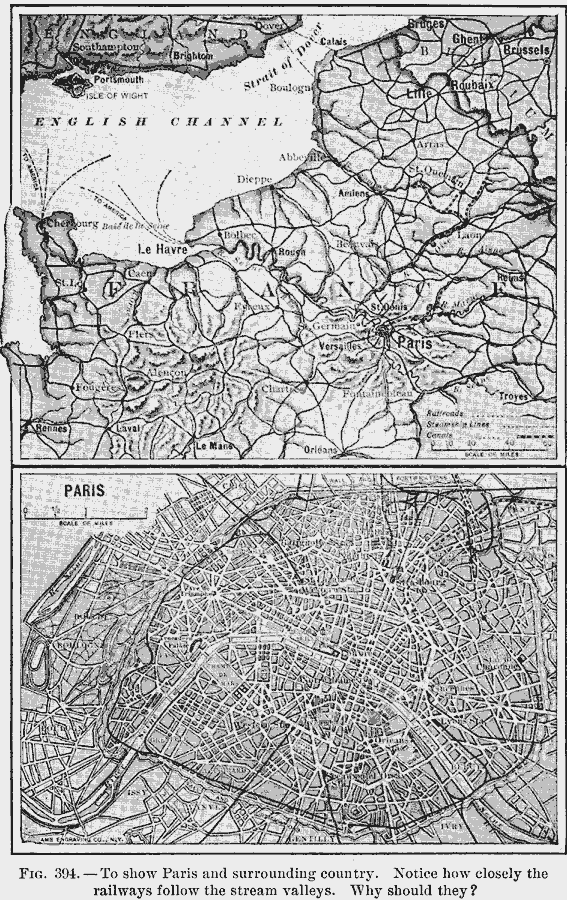
Description: A map of northern France and Paris in 1910, showing a detail of the city and surrounding area to the English Channel. This map shows primary railroads, steamship routes, and canals in the region.
Place Names: France, Orleans, �Paris, �Versaille
ISO Topic Categories: oceans,
location,
inlandWaters
Keywords: Paris and Northern France, political, �transportation, local jurisdictions, railroads,
water routes, oceans,
location,
inlandWaters, Unknown, 1910
Source: Ralph S. Tarr, B.S., F.G.S.A. and Frank M. McMurry, Ph.D., New Geographies (Second Book) (New York , NY: The MacMillan Company, 1910) 287
Map Credit: Courtesy the private collection of Roy Winkelman |
|