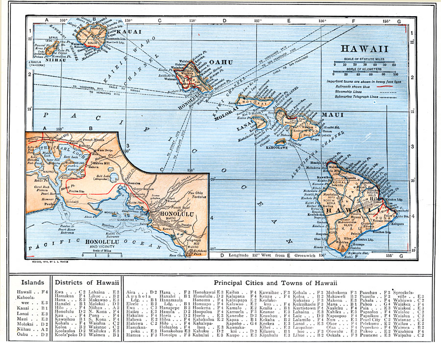
Description: A map from 1914 of the Hawaiian Islands showing the main islands, the capital of Honolulu on the island of Oahu, district boundaries, cities, towns, ports, railroads, principal steamship lines, submarine cable routes, terrain, and coastal features. An inset map details the vicinity of Pearl Harbor (Pearl Lochs) and Honolulu.
Place Names: Hawaii, Hilo, �Hana, �Honolulu, �Kaneohe, �Pahoa, �Pearl City, �Waime
ISO Topic Categories: boundaries,
inlandWaters,
location,
oceans,
transportation
Keywords: Hawaii, physical, �political, �transportation, physical features, county borders, water routes,
railroads, boundaries,
inlandWaters,
location,
oceans,
transportation, Unknown, 1914
Source: , The New Encyclopedic Atlas and Gazetteer of the World (New York, NY: P. F. Collier and Son, 1914) 18
Map Credit: Courtesy the private collection of Roy Winkelman |
|