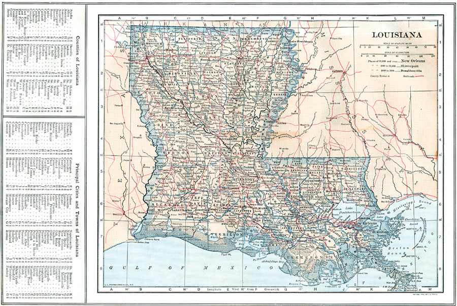
Description: A map from 1914 of Louisiana showing the State capital of Baton Rouge, counties and county seats, major cities and towns, railroads, canals, lakes, rivers, the course of the Mississippi River, and coastal features of the Gulf of Mexico. A grid reference in the margin of the map lists counties, principal cities, and towns of Louisiana.
Place Names: Louisiana, New Orleans, �Baton Rouge, �Leesville, �Alexandria, �Clinton, �Columbia, �Harrisonburg, �Madisonville, �Rayvill
ISO Topic Categories: boundaries,
location,
inlandWaters,
transportation
Keywords: Louisiana, physical, �political, �transportation, physical features, county borders, railroads, boundaries,
location,
inlandWaters,
transportation, Unknown, 1914
Source: , The New Encyclopedic Atlas and Gazetteer of the World (New York, NY: P. F. Collier and Son, 1914) 25
Map Credit: Courtesy the private collection of Roy Winkelman |
|