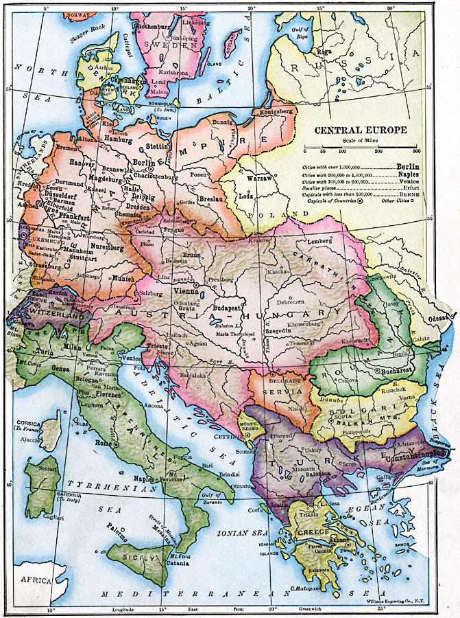
Description: A map of central Europe in 1910 showing established country borders, major cities and capitals, rivers, and mountain systems. The countries shown are Denmark, German Empire, Luxemburg, Switzerland, Austria–Hungary, Italy, Montenegro, Servia, Roumania, Bulgaria, European Turkey, and Greece.
Place Names: Western and Central Europe, Austria-Hungary, �Bulgaria, �Denmark, �German Empire, �Greece, �Italy, �Poland, �Romania, �Serbia, �Sweden, �Switzerland, �Turke
ISO Topic Categories: oceans,
location,
inlandWaters,
boundaries
Keywords: Central Europe, statistical, �political, country borders,
major political subdivisions, population, water routes, oceans,
location,
inlandWaters,
boundaries, Unknown, 1910
Source: Ralph S. Tarr, B.S., F.G.S.A. and Frank M. McMurry, Ph.D., New Geographies (Second Book) (New York , NY: The MacMillan Company, 1910) 308
Map Credit: Courtesy the private collection of Roy Winkelman |
|