mapsMaps ETC Site map
 Maps ETC > Globes and Multi-continent > A Complete Map of Globes and Multi-continent > Map of the World showing possessions of United States, Germany, France, and the Netherlands, 1910
Site Map 

Map of the World showing possessions of United States, Germany, France, and the Netherlands, 1910

Map of the World showing possessions of United States, Germany, France, and the Netherlands


Title: Map of the World showing possessions of United States, Germany, France, and the Netherlands
Projection: Unknown,
Source Bounding Coordinates:
W: 180 E: 180 N: 80 S: -60

Main Map Page
Zoomify Version
B/W PDF Version
Color PDF Version
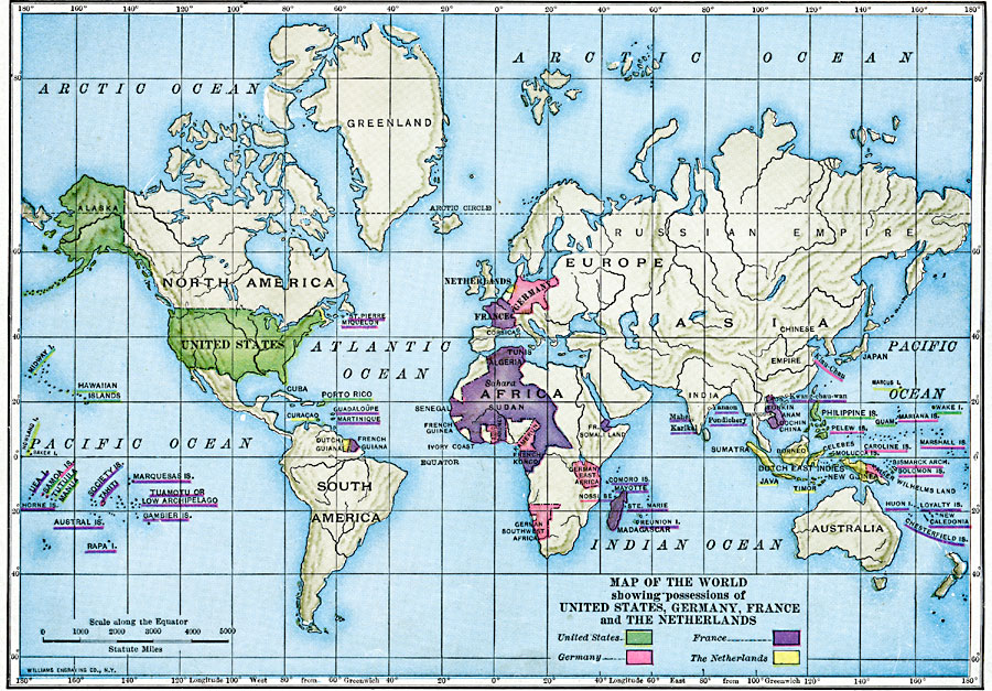
Description: A map from 1910 of the World color–coded to possessions of United States, Germany, France, and the Netherlands.
Place Names: A Complete Map of Globes and Multi-continent, France, Germany, Netherlands, United States,
ISO Topic Categories: oceans, location, inlandWaters, boundaries
Keywords: Map of the World showing possessions of United States, Germany, France, and the Netherlands, statistical, political, transportation, country borders, major political subdivisions, population, water routes, oceans, location, inlandWaters, boundaries, Unknown, 1910
Source: Ralph S. Tarr, B.S., F.G.S.A. and Frank M. McMurry, Ph.D., New Geographies (Second Book) (New York , NY: The MacMillan Company, 1910) 308
Map Credit: Courtesy the private collection of Roy Winkelman
SearchLicensePDF HelpGIS Help Google Earth Help Zoomify Help

 Maps ETC > Globes and Multi-continent > A Complete Map of Globes and Multi-continent > Map of the World showing possessions of United States, Germany, France, and the Netherlands, 1910
Site Map