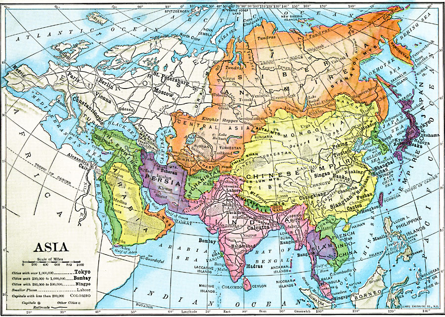
Description: A map of Asia from 1910 showing country boundaries at the time, foreign possessions, major cities, rivers, lakes, terrain, and coastal features. This map shows the principal railways of the region with connections to Europe. This map shows the extent of the Russian Empire and Turkish Ottoman Empire in Asia, the Empire of Japan and the Chinese Empire.
Place Names: A Complete Map of Asia, Afghanistan, �Arabia, �Borneo, �China, �Chinese Empire, �India, �Indonesia, �Japan, �Kazakhstan, �Korea, �Mongolia, �Nepal, �Pakistan, �Persia, �Philippines, �Russia, �Russian Empire, �Siberia, �Sumatra, �Thailand, �Tibet, �Turkish Empire, �Russian Empire, �Chinese Empire, �Japanese Empir
ISO Topic Categories: oceans,
location,
inlandWaters,
boundaries
Keywords: Asia, statistical, �political, �transportation, country borders,
major political subdivisions, population, water routes,
railroads, oceans,
location,
inlandWaters,
boundaries, Unknown, 1910
Source: Ralph S. Tarr, B.S., F.G.S.A. and Frank M. McMurry, Ph.D., New Geographies (Second Book) (New York , NY: The MacMillan Company, 1910) 340
Map Credit: Courtesy the private collection of Roy Winkelman |
|