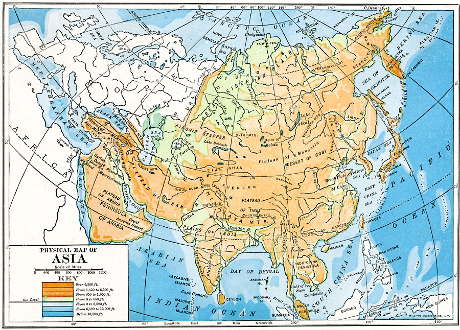
Description: A map from 1910 of Asia, showing physical features and general elevations. This map uses color-contours to show land elevations ranging from below sea level around the Caspian Sea to over 6,500 feet, and water depths from sea level to below 13,000 feet. The light blue tints indicate the submerged continental plateau of the region. This map shows mountain systems, plateaus, plains, steppes, deserts, major river systems, lakes, coastal features, and islands.
Place Names: A Complete Map of Asia, Afghanistan, �Arabia, �Borneo, �China, �Chinese Empire, �India, �Indonesia, �Japan, �Kazakhstan, �Korea, �Mongolia, �Nepal, �Pakistan, �Persia, �Philippines, �Russia, �Russian Empire, �Siberia, �Sumatra, �Thailand, �Tibet, �Turkish Empire,
ISO Topic Categories: oceans,
location,
inlandWaters,
elevation
Keywords: Physical Asia, physical, topographical, oceans,
location,
inlandWaters,
elevation, Unknown, 1910
Source: Ralph S. Tarr, B.S., F.G.S.A. and Frank M. McMurry, Ph.D., New Geographies (Second Book) (New York , NY: The MacMillan Company, 1910) 340
Map Credit: Courtesy the private collection of Roy Winkelman |
|