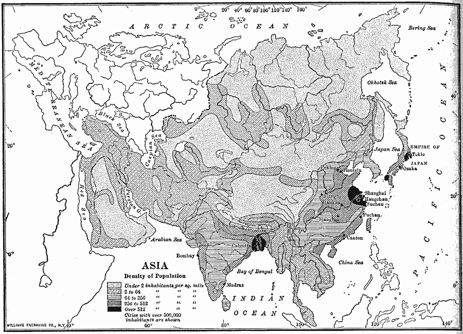
Description: A map from 1910 showing the political boundaries and the distribution of population density of Asia at the time. This map uses gradated shading to shows areas of population densities ranging from under 2 inhabitants per square mile to over 512 inhabitants per square mile. Cities with populations over 500,000 inhabitants are shown.
Place Names: A Complete Map of Asia, Afghanistan, �Arabia, �Borneo, �China, �Chinese Empire, �India, �Indonesia, �Japan, �Kazakhstan, �Korea, �Mongolia, �Nepal, �Pakistan, �Persia, �Philippines, �Russia, �Russian Empire, �Siberia, �Sumatra, �Thailand, �Tibet, �Turkish Empire,
ISO Topic Categories: oceans,
location,
inlandWaters
Keywords: Population Density of Asia, statistical, kPopulation, population, oceans,
location,
inlandWaters, Unknown, 1910
Source: Ralph S. Tarr, B.S., F.G.S.A. and Frank M. McMurry, Ph.D., New Geographies (Second Book) (New York , NY: The MacMillan Company, 1910) 346
Map Credit: Courtesy the private collection of Roy Winkelman |
|