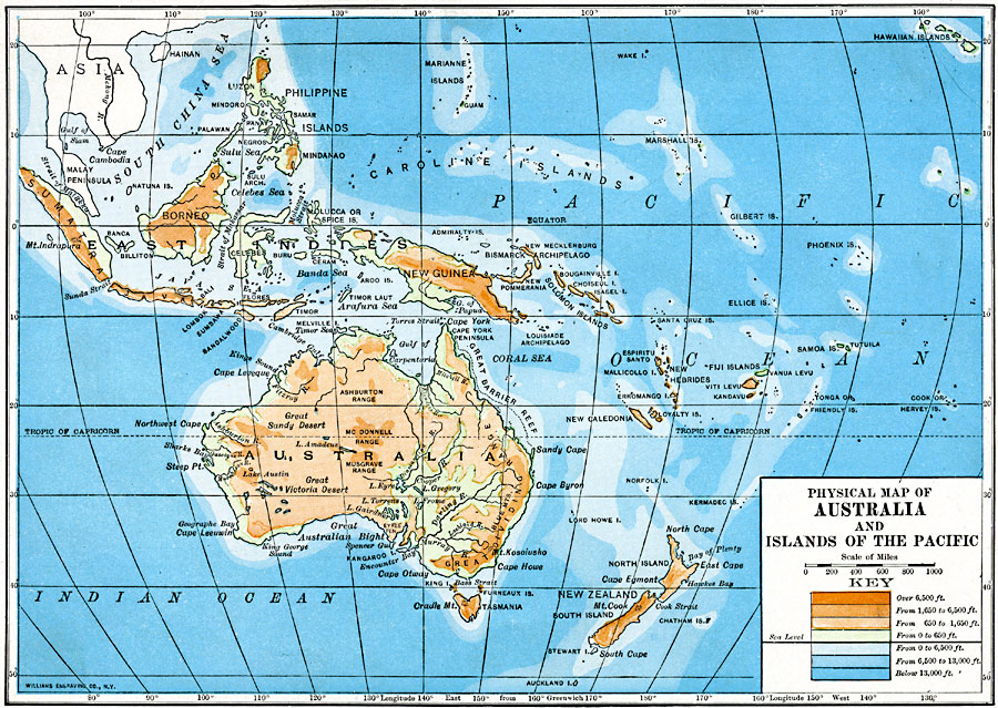
Description: Physical map of Australia and islands of the Pacific in 1910 showing general color–coded elevations and water depths from 13,000 feet below sea level to over 6,500 feet above sea level. This map covers Australia and New Zealand, and from Sumatra in the East Indies to longitude 160 West from Greenwich, including the Hawaiian Islands.
Place Names: Regional Pacific Ocean, Alice Springs, Brisbane, Cairns, Canberra, Darwin, Fiji Islands, Mackay, Melbourne, Newcastle, New Guinea, New Zealand, Solomon Islands, Sydney, Tasmania, Townsvill
ISO Topic Categories: physical, kWorldPacific
Keywords: Physical map of Australia and islands of the Pacific, physical, topographical, physical, kWorldPacific, Unknown, 1910
Source: Ralph S. Tarr, B.S., F.G.S.A. and Frank M. McMurry, Ph.D., New Geographies (Second Book) (New York , NY: The MacMillan Company, 1910) 390
Map Credit: Courtesy the private collection of Roy Winkelman |
|