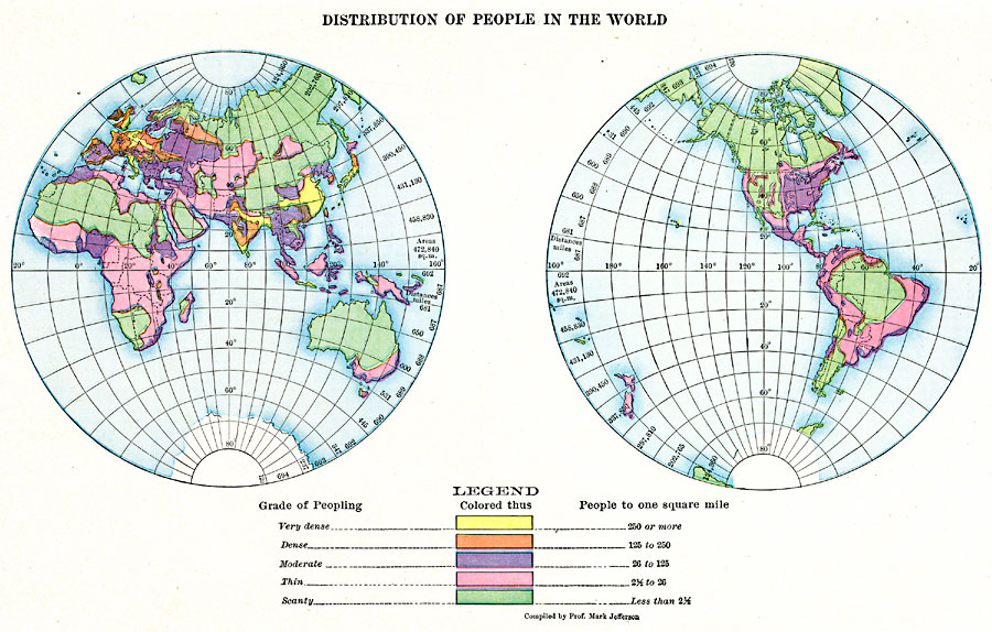
Description: A map from 1910 showing the distribution of people or population density in the world at the time. This map is color–coded to show areas ranging in population density from very dense (250 or more people per square mile), dense (125 to 250 people per square mile), moderate (26 to 125 people per square mile), thin (2 ½ to 26 people per square mile), down to areas where the population density is less than 2 ½ people per square mile.
Place Names: A Complete Map of Globes and Multi-continent, Africa, �Antarctica, �Asia, �Australia, �Europe, �North America, �Pacific Ocean, �South Americ
ISO Topic Categories: oceans,
location,
inlandWaters
Keywords: Distribution of People in the World, statistical, kPopulation, population, oceans,
location,
inlandWaters, Unknown, 1910
Source: Ralph S. Tarr, B.S., F.G.S.A. and Frank M. McMurry, Ph.D., New Geographies (Second Book) (New York , NY: The MacMillan Company, 1910) 400
Map Credit: Courtesy the private collection of Roy Winkelman |
|