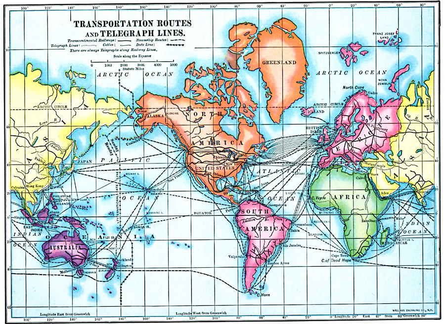
Description: A map from 1910 showing the location of then–current transcontinental railway and steamship transportation routes, submarine cables, and telegraph lines in the world. The map also shows the International Date Line.
Place Names: A Complete Map of Globes and Multi-continent, Asia, �Australia, �Europe, �North America, �Pacific Ocean, �South America, �Afric
ISO Topic Categories: oceans,
location,
inlandWaters
Keywords: Transportation Routes and Telegraph Lines, statistical, �transportation, industry, railroads,
water routes, oceans,
location,
inlandWaters, Unknown, 1910
Source: Ralph S. Tarr, B.S., F.G.S.A. and Frank M. McMurry, Ph.D., New Geographies (Second Book) (New York , NY: The MacMillan Company, 1910) 412
Map Credit: Courtesy the private collection of Roy Winkelman |
|