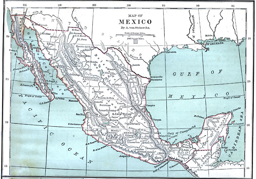
Description: A map from 1870 showing the physical features of Mexico, including mountain systems, plateaus, peninsulas, lakes, rivers, and coastal features. Major cities and ports are shown. A block equaling 1,000 square miles at the same map scale is given for comparative area size.
Place Names: Mexico, Chihuahua, �Ures, �El Altar, �Hermosillo, �Hidalgo, �Tampico, �Campeachy, �Tuxtla, �Oajaca, �Guerrero, �Queretaro, �Mexico City, �Guadalajara, �San Luis Potosi, �Zacatecas, �Durang
ISO Topic Categories: boundaries,
inlandWaters,
location,
oceans
Keywords: Mexico, physical, �political, physical features,
topographical, country borders, boundaries,
inlandWaters,
location,
oceans, Unknown, 1870
Source: A. Von Steinwehr, Intermediate Geography (Cincinnati, OH: Wilson, Hinkle & Co., 1870) 56
Map Credit: Courtesy the private collection of Roy Winkelman |
|
