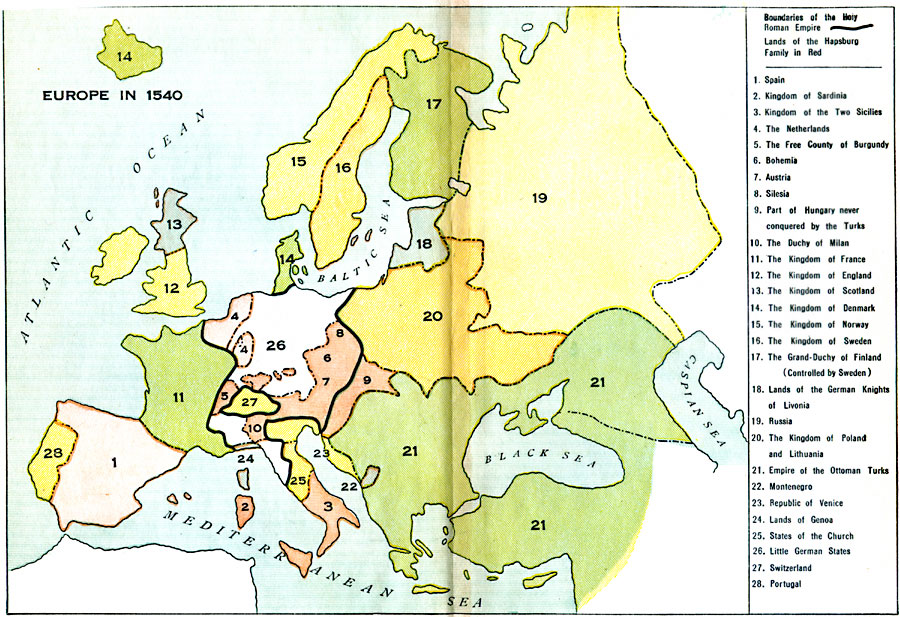
Description: A colored outline map of Europe as it was in 1540, including the Holy Roman Empire, Lands of the Habsburgs, the Kingdom of the Two Sicilies, the Duchy of Milan, the Lands of the German Knights of Livonia, and several other powers of the period. Territories are numbered and referenced on the map.
Place Names: A Complete Map of Europe, Spain, �Sardinia, �Kingdom of the Two Sicilies, �Netherlands, �Free County of Burgundy, �Bohemia, �Austria, �Silesia, �Duchy of Milan, �Hungary, �France, �England, �Scotland, �Denmark, �Norway, �Sweden, �Finland, �Lands of the German Knights of Livoni
ISO Topic Categories: boundaries,
oceans
Keywords: Europe, physical, �political, physical features, country borders, boundaries,
oceans, Unknown, 1540
Source: L. P. Benezet, The Story of the Map of Europe (Chicago, Illinois: Scott, Foresman and Company, 1916) 92-93
Map Credit: Courtesy the private collection of Roy Winkelman |
|