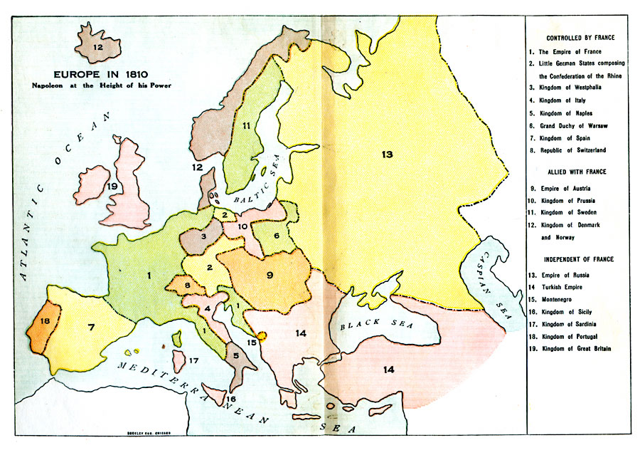
Description: A colored outline map of Europe in 1810, when Napoleon was at the height of his power. The map shows the European countries that were controlled by France, allied with France, or independent of France. Territories are numbered and referenced on the map.
Place Names: A Complete Map of Europe, France, �Confederation of the Rhine, �Westphalia, �Italy, �Naples, �Warsaw, �Spain, �Switzerland, �Austria, �Prussia, �Sweden, �Denmark and Norway, �Russia, �Turkish Empire, �Montenegro, �Sicily, �Sardinia, �Portugal, �Great Britai
ISO Topic Categories: boundaries,
oceans
Keywords: Europe, physical, �political, �historical, kNapoleonBonaparte, physical features, country borders, boundaries,
oceans, Unknown, 1810
Source: L. P. Benezet, The Story of the Map of Europe (Chicago, Illinois: Scott, Foresman and Company, 1916) 120-121
Map Credit: Courtesy the private collection of Roy Winkelman |
|