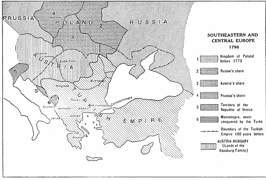
Description: A map of southeastern and central Europe in 1796, showing the partition of the Kingdom of Poland, portions of the Republic of Venice, Austria–Hungary, and the extent of the Turkish Ottoman Empire in Europe at the time. The map shows the Kingdom of Poland before 1773, and the portions claimed by Russia, Austria, and Prussia after the Partition of Poland. The map shows the location of Montenegro, never conquered by the Turks, and the boundary of the Ottoman Empire 100 years before 1796.
Place Names: Southeastern Europe, Poland, �Russia, �Austria, �Turkish Empire, �Vienna, �Buda-Pest, �Warsaw, �Bukharest, �Belgrade, �Sofia, �Kavala, �Constantinople, �Athens, �Janina, �Scutari, �Monasti
ISO Topic Categories: boundaries,
inlandWaters,
location,
oceans
Keywords: Southeastern and Central Europe, physical, �political, kEuropeanOttomanEmpire, kPartitionOfPoland, physical features, country borders, boundaries,
inlandWaters,
location,
oceans, Unknown, 1796
Source: L. P. Benezet, The Story of the Map of Europe (Chicago, IL: Scott, Foresman and Company, 1916) 168
Map Credit: Courtesy the private collection of Roy Winkelman |
|