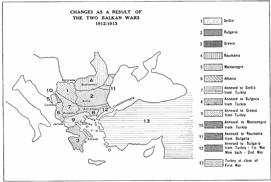
Description: A map of the territorial changes as a result of the two Balkan wars in 1912–1913 between the Empire of the Ottoman Turks and the Balkan League (Bulgaria, Greece, Serbia, and Montenegro). This map shows the territories of Serbia, Bulgaria, Greece, Roumania, Montenegro, Albania, and the territorial annexations from Turkey to Serbia, Bulgaria, Greece, and Montenegro, the territory annexed to Roumania from Bulgaria, and the territory annexed to Bulgaria after the first Balkan War but won back by Turkey in the second war.
Place Names: Southeastern Europe, Constantinople, �Belgrade, �Bukharest, �Sofia, �Adrianople, �Kavala, �Janina, �Athen
ISO Topic Categories: boundaries,
location,
oceans,
inlandWaters
Keywords: Regional Changes from the Balkan Wars, physical, �political, �historical, physical features, country borders,
major political subdivisions, boundaries,
location,
oceans,
inlandWaters, Unknown, 1912–1913
Source: L. P. Benezet, The Story of the Map of Europe (Chicago, IL: Scott, Foresman and Company, 1916) 198
Map Credit: Courtesy the private collection of Roy Winkelman |
|
