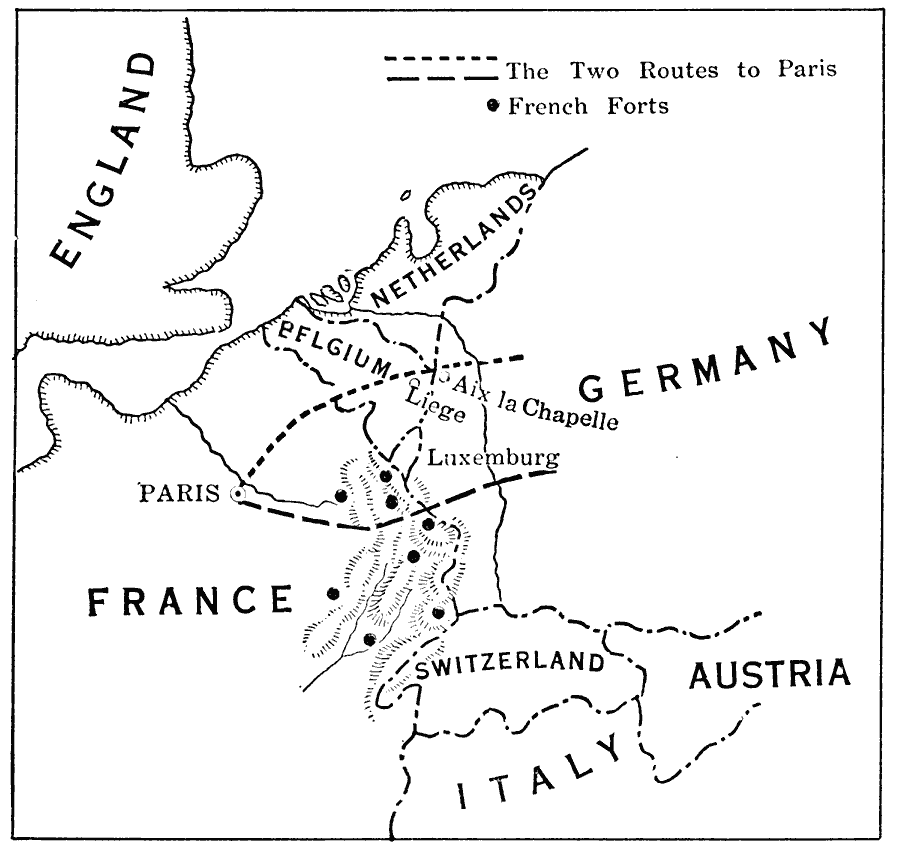
Description: A sketch map of the two routes from Germany to Paris proposed for the path of German invasion at the start of WWI under the Schlieffen Plan. The map shows the northern route through Aix la Chapelle and Liege in Belgium, and the southern route through Luxemburg. The sites of the French forts in the vicinity of the southern route are shown, and help explain Moltke's choice of the northern route.
Place Names: Western and Central Europe, Netherlands, �England, �Belgium, �France, �Switzerland, �Austria, �Italy, �Luxemburg, �Pari
ISO Topic Categories: boundaries,
location,
oceans,
inlandWaters,
transportation
Keywords: Proposed Routes of the German Army on Paris, physical, �political, �transportation, �historical, kWWI, physical features, country borders, roads, WWI, boundaries,
location,
oceans,
inlandWaters,
transportation, Unknown, 1914
Source: L. P. Benezet, The Story of the Map of Europe (Chicago, IL: Scott, Foresman and Company, 1916) 220
Map Credit: Courtesy the private collection of Roy Winkelman |
|