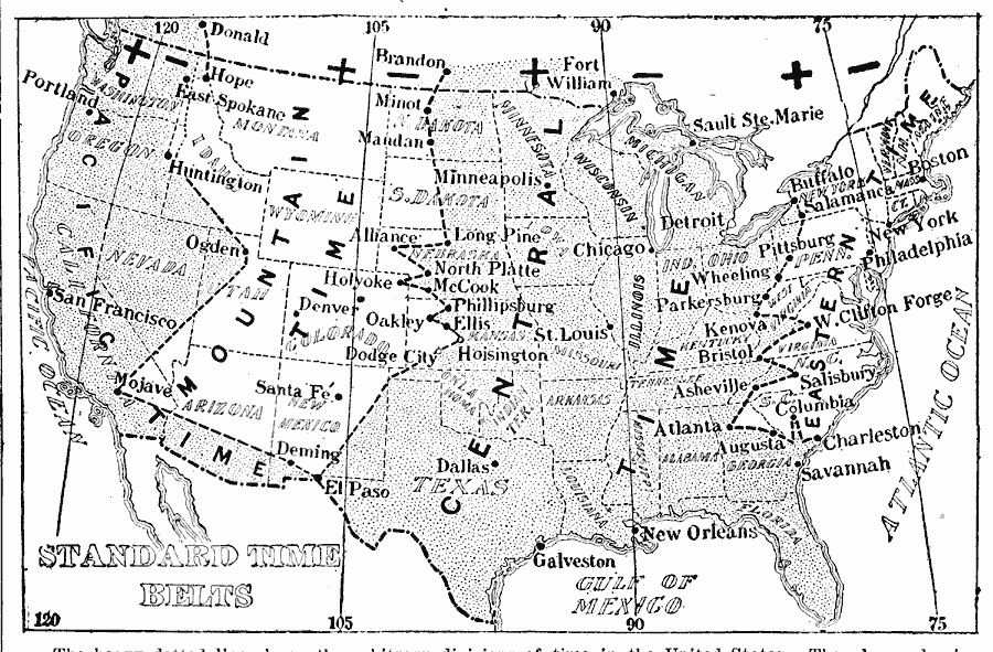
Description: A map from 1903 of the United States showing the time zones as they were then established. "The heavy dotted line shows the arbitrary divisions of time in the United States. The plus and minus marks on either side of the meridian lines show whether it is necessary to add or to subtract from the standard time of points east or west of these lines, to arrive at actual, or Greenwich time." — The American Almanac, Year–Book, Cyclopedia and Atlas, 1903.
Place Names: A Complete Map of the United States, Boston, �New York, �Philadelphia, �Charleston, �Savannah, �Pittsburg, �Buffalo, �Atlanta, �New Orleans, �Bristol, �Asheville, �Detroit, �Chicago, �St. Louis, �Galveston, �Dallas, �Minneapolis, �Dodge City, �Santa Fe, �Huntington, �Ogden, �Mojave, �San
ISO Topic Categories: boundaries,
inlandWaters,
location,
oceans,
society
Keywords: Standard Time Belts, physical, �political, �time zones, physical features, country borders,
major political subdivisions, boundaries,
inlandWaters,
location,
oceans,
society, Unknown, 1903
Source: , The American Almanac, Year-Book, Cyclopedia and Atlas (New York, NY: New York American and Journal, 1903) 2
Map Credit: Courtesy the private collection of Roy Winkelman |
|