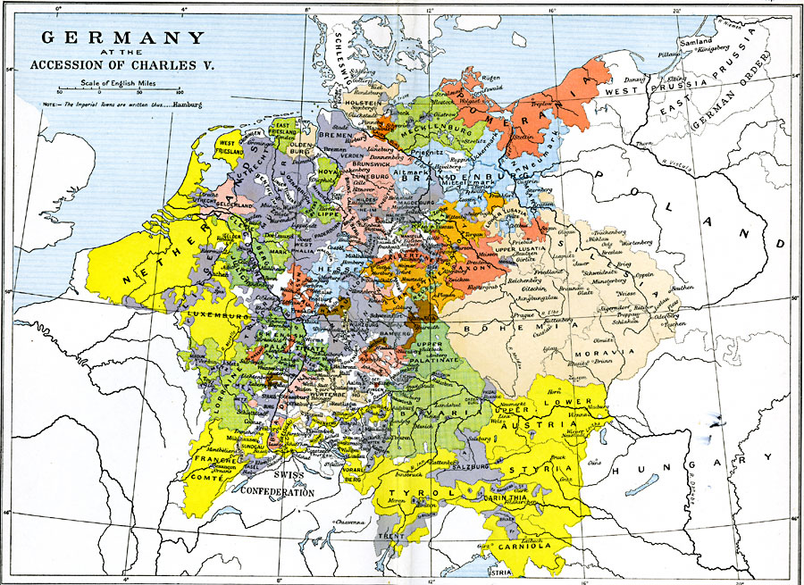
Description: Map showing the German, Netherland, French, and northern Italian regions of the Holy Roman Empire at the Accession of Charles V in 1519. This map is color–coded to show the various territorial claims, with Imperial towns shown in a different type font.
Place Names: Germany, Austria, �Bavaria, �Bohemia, �France, �Germany, �Luxemburg, �Mecklenburg, �Netherlands, �Pomerania, �Saxony, �Silesia, �Tyro
ISO Topic Categories: oceans,
location,
inlandWaters,
boundaries
Keywords: Germany at the Accession of Charles V, political, country borders,
major political subdivisions,
local jurisdictions, oceans,
location,
inlandWaters,
boundaries, Unknown, 1519
Source: Ward, Prothero, and Leathes, The Cambridge Modern History Atlas (New York, NY: The Macmillan Company, 1912)
Map Credit: Courtesy the private collection of Roy Winkelman |
|