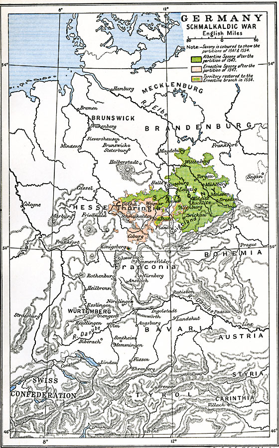
Description: A map of Hesse–Thuringia and Saxony in Germany during the Schmalkaldic War (1547–1554) between the Holy Roman Empire under Charles V and the allied forces of Lutheran princes known as the Schmalkaldic League. This map is color–coded to show Albertine Saxony after the partition of 1547, Ernestine Saxony after the partition of 1547, and the territory restored to the Ernestine branch in 1554. The map shows the cities of Wittenberg, Dresden, Altenburg, Leipzig, Neustadt, Gotha, and Königsberg in the contested territories.
Place Names: Germany, Dresden, �Hesse, �Leipzig, �Saxony, �Thuringi
ISO Topic Categories: oceans,
location,
inlandWaters
Keywords: Germany - Schmalkaldic War, historical, �political, country borders,
major political subdivisions,
local jurisdictions, other military, oceans,
location,
inlandWaters, Unknown, 1547–1554
Source: Ward, Prothero, and Leathes, The Cambridge Modern History Atlas (New York, NY: The Macmillan Company, 1912)
Map Credit: Courtesy the private collection of Roy Winkelman |
|