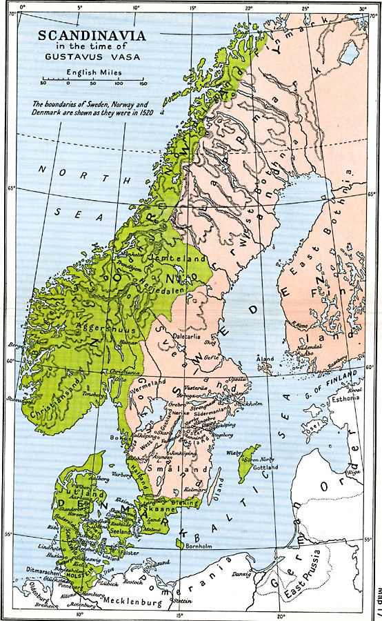
Description: A map showing Scandinavia in the time of Gustavus Vasas (Gustav I of Sweden, 1496–1560). This map is color–coded to show the Swedish territories of Finmark, Lappmark, East and West Bothnia, Finland, Svealand, Gothland, Småland, and Öland, and the Danish territories of Jutland, Schleswig, Holstein, Seeland, Skaane, Bornholm, Gottland, Halland, Christiansand, Bergen, Aggershuus, Trondhjem, Herjedalen, Jemteland, and the coastal Nordland. The map shows major cities, rivers, coastal features, and mountain systems in the region.
Place Names: Scandinavia, Denmark, �Finland, �Norway, �Swede
ISO Topic Categories: oceans,
location,
inlandWaters,
boundaries
Keywords: Scandinavia in the time of Gustavus Vasa, political, country borders,
major political subdivisions,
local jurisdictions, oceans,
location,
inlandWaters,
boundaries, Unknown, 1520
Source: Ward, Prothero, and Leathes, The Cambridge Modern History Atlas (New York, NY: The Macmillan Company, 1912)
Map Credit: Courtesy the private collection of Roy Winkelman |
|