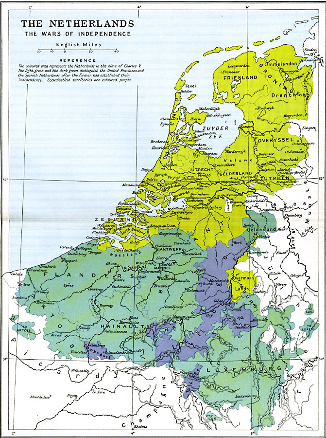
Description: A map of the Netherlands between 1568 under Charles V to independence in1648 by the Treaty of Münster, subtitled "The Wars of Independence." This map is color–coded to show boundaries before and after independence was declared. "The coloured area represents the Netherlands in the time of Charles V. The light green and the dark green distinguish the United Provinces and the Spanish Netherlands after the former had established their independence. Ecclesiastical territories are coloured purple."
Place Names: Low Countries, Antwerp, �Brabant, �Flanders, �Friesland, �Groningen, �Holland, �Luxemburg, �Netherlands, �Utrech
ISO Topic Categories: oceans,
location,
inlandWaters,
boundaries
Keywords: The Netherlands, political, �historical, country borders,
major political subdivisions,
local jurisdictions, historical event, oceans,
location,
inlandWaters,
boundaries, Unknown, 1568–1648
Source: Ward, Prothero, and Leathes, The Cambridge Modern History Atlas (New York, NY: The Macmillan Company, 1912)
Map Credit: Courtesy the private collection of Roy Winkelman |
|