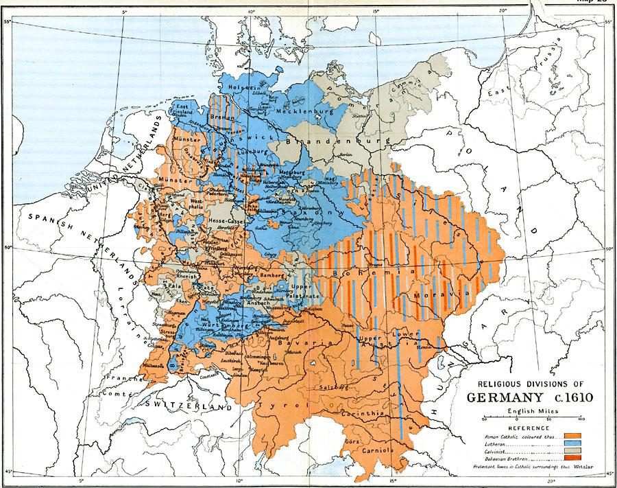
Description: Map of Germany during the reformation showing the religious divisions of Germany prior to the Thirty Years' War, circa1610. This map is color–coded to show the territorial boundaries of the Roman Catholics in orange, Lutherans in blue, Calvinists in gray, and the Bohemian Brethren in dark orange. The extension of reformed opinions is indicated by bars of color. State boundaries, important cities, and rivers are also shown.
Place Names: Germany, Berlin, �Bremen, �Cologne, �Dresden, �Frankfurt am Main, �Hamburg, �Hannover, �Mannheim, �Nuremberg, �Wiesbade
ISO Topic Categories: oceans,
location,
inlandWaters,
boundaries
Keywords: Religious Divisions of Germany, political, �religious, kReformation, local jurisdictions,
country borders,
major political subdivisions, oceans,
location,
inlandWaters,
boundaries, Unknown, 1610
Source: Ward, Prothero, and Leathes, The Cambridge Modern History Atlas (New York, NY: The Macmillan Company, 1912)
Map Credit: Courtesy the private collection of Roy Winkelman |
|