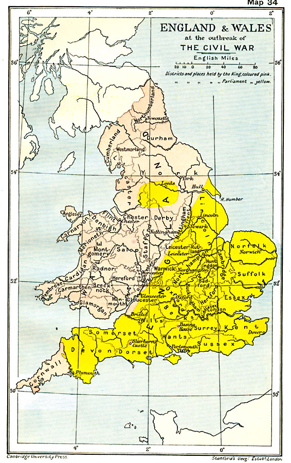
Description: A map of England and Wales at the outbreak of the English Civil War (1642–1651). The map is color–coded to show the districts and places controlled by the King Charles I of England in pink and those controlled by Parliament in Yellow.
Place Names: United Kingdom, England, �London, �Newcastle, �Plymouth, �United Kingdom, �Wales,
ISO Topic Categories: oceans,
location,
inlandWaters,
boundaries
Keywords: England and Wales at the outbreak of The English Civil War, political, �historical, local jurisdictions,
country borders,
major political subdivisions, other military, oceans,
location,
inlandWaters,
boundaries, Unknown, 1642
Source: Ward, Prothero, and Leathes, The Cambridge Modern History Atlas (New York, NY: The Macmillan Company, 1912)
Map Credit: Courtesy the private collection of Roy Winkelman |
|