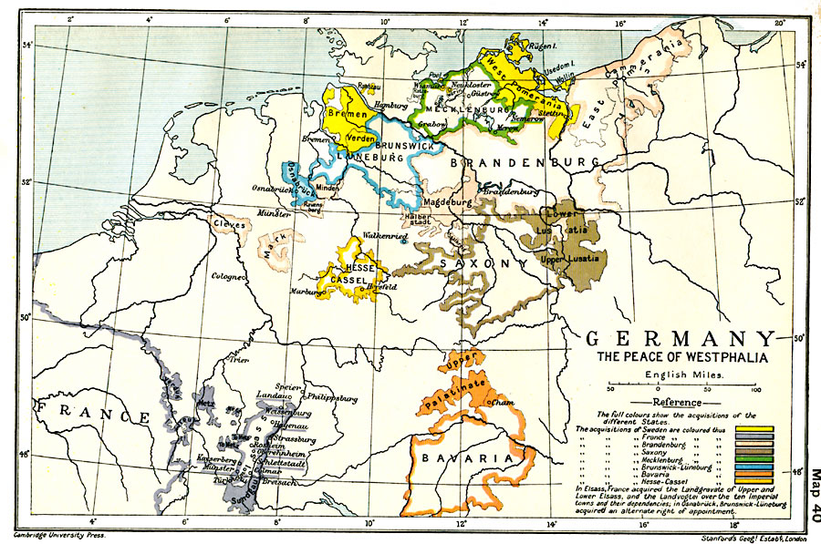
Description: A map of northern Germany showing the political boundaries established by the Peace of Westphalia in 1648 at the close of the Thirty Years' War. The Thirty Years' War was the conflict, primarily in the German region of the Holy Roman Empire, between Protestant and Catholic political powers. The Peace of Westphalia granted the right of individual rulers to establish the official religion, Protestant or Catholic, in their domains. This map shows the territorial boundaries and acquisitions under the Peace of Westphalia for Sweden and France, and the German states of Brandenburg, Saxony, Mecklenburg, Brunswick-Lüneburg, Bavaria, and Hesse-Cassel. Map note: "In Elsass, France acquired the Landgravate of Upper and Lower Elsass, and the Landvogtei over the ten Imperial towns and their dependencies; in Osnabrück, Brunswick-Lüneburg acquired an alternate right of appointment."
Place Names: Germany, Bavaria, �Brandenburg, �Bremen, �France, �Germany, �Mecklenburg, �Saxony, �Verde
ISO Topic Categories: oceans,
location,
inlandWaters,
boundaries
Keywords: Germany, political, �historical, local jurisdictions,
country borders,
major political subdivisions, other military,
historical event, oceans,
location,
inlandWaters,
boundaries, Unknown, 1648
Source: Ward, Prothero, and Leathes, The Cambridge Modern History Atlas (New York, NY: The Macmillan Company, 1912)
Map Credit: Courtesy the private collection of Roy Winkelman |
|