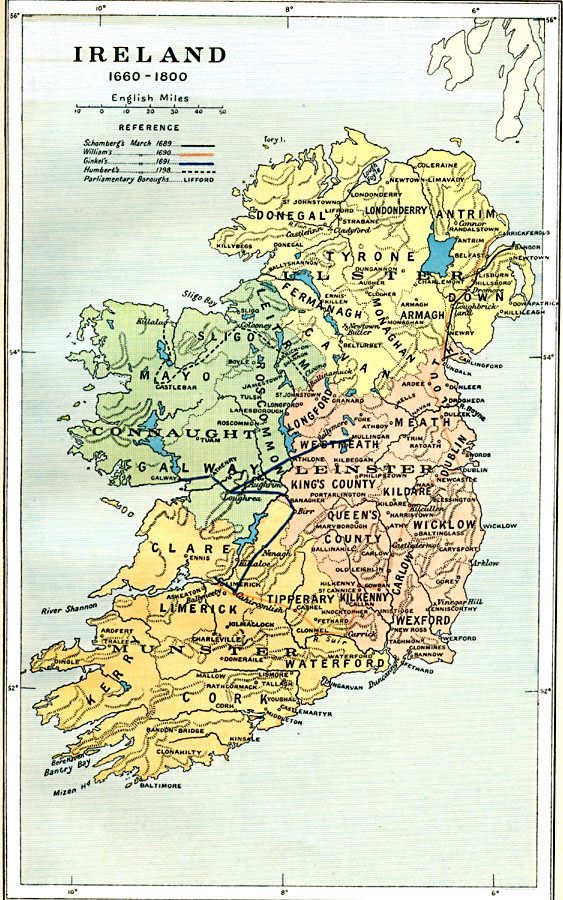
Description: A map of Ireland from the restoration of Irish monarchy under Charles II in 1660 to its merging to Great Britain in 1800. The map shows the four Irish provinces of Ulster, Connaught, Leinster, and Munster, and important cities and battle sites of the period. The map also shows the military route of Duke Frederick Schomberg on his march against the Jacobean supporters of James II from Bangor to Dundalk (1689), the route of William III (William of Orange) from Carrickfergus to Dromor (Donmor) and the Battle of the Boyne, then on to Limerick (1690), the route of Godert de Ginkel from Mullingar to Ballymore, Galway, and Limerick (1691), and the route of the French General Humbert from Killala to Ballinamuck during the Irish Rebellion of 1798. The map shows the Parliamentary Boroughs established when the Irish monarchy became a part of Great Britain on 1, January, 1801.
Place Names: Ireland, Cork, �Dublin, �Galway, �Limerick, �Monaghan, �Slig
ISO Topic Categories: oceans,
location,
inlandWaters,
boundaries
Keywords: Ireland, political, �historical, local jurisdictions,
country borders,
major political subdivisions, historical event,
other military, oceans,
location,
inlandWaters,
boundaries, Unknown, 1660–1800
Source: Ward, Prothero, and Leathes, The Cambridge Modern History Atlas (New York, NY: The Macmillan Company, 1912)
Map Credit: Courtesy the private collection of Roy Winkelman |
|