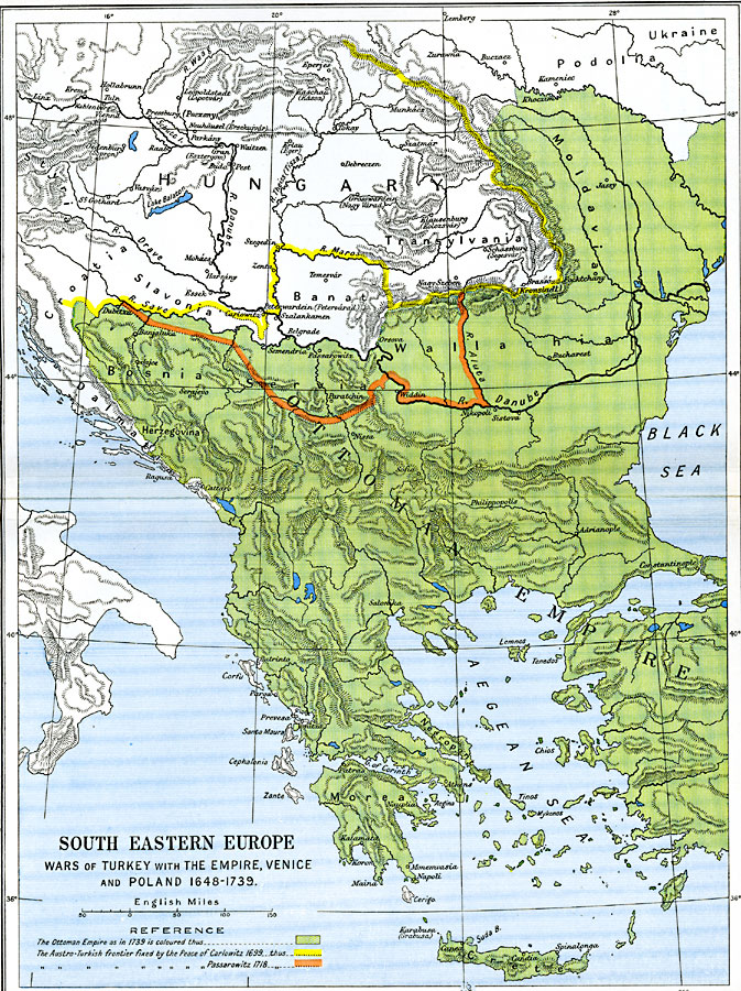
Description: A map of southeastern Europe, subtitled "Wars of Turkey with the Empire, Venice and Poland 1648–1739." This map is color–coded to show the extent of the European Turkish Ottoman Empire in 1739, and shows the border of the Austro–Turkish frontiers fixed by the Peace of Carlowitz in 1699 and the Peace of Passarowitz in 1718. The map shows important cities of the time, including several with variations of names, such as Klausenburg (Kolozsvár), Brassó (Kronstadt), and Peterwardein (Petervárd). The map also shows major rivers and mountain systems.
Place Names: Southeastern Europe, Bosnia, �Bucharest, �Constantinople, �Greece, �Moldavia, �Ottoman Empire, �Poland, �Turkey, �Wallachi
ISO Topic Categories: oceans,
location,
inlandWaters,
boundaries
Keywords: South Eastern Europe, political, �historical, kEuropeanOttomanEmpire, local jurisdictions,
country borders,
major political subdivisions, historical event,
other military, oceans,
location,
inlandWaters,
boundaries, Unknown, 1648–1739
Source: Ward, Prothero, and Leathes, The Cambridge Modern History Atlas (New York, NY: The Macmillan Company, 1912)
Map Credit: Courtesy the private collection of Roy Winkelman |
|
