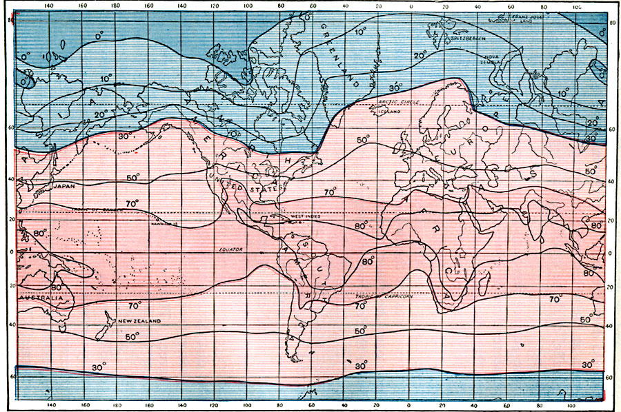
Description: A map of the Earth from 1896, showing averaged annual global temperatures in degrees Fahrenheit, and delineated by isotherms. The map is color–coded to show climate zones ranging from below zero degrees Fahrenheit to a mean 80 degrees Fahrenheit annual temperature.
Place Names: A Complete Map of Globes and Multi-continent, Africa, �Antarctica, �Asia, �Australia, �Europe, �North America, �South Americ
ISO Topic Categories: inlandWaters,
location,
oceans,
climatologyMeteorologyAtmosphere
Keywords: Average Global Temperatures, physical, �meteorological, kClimate, physical features, temperature, inlandWaters,
location,
oceans,
climatologyMeteorologyAtmosphere, Unknown, 1896
Source: Frank Waldo, Elementary Meteorology (New York, New York: American Book Company, 1896) 52
Map Credit: Courtesy the private collection of Roy Winkelman |
|