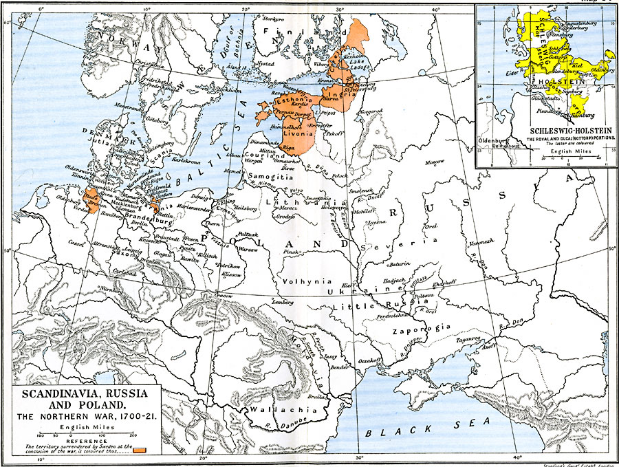
Description: A map of Scandinavia, Russia, and Poland, subtitled "The Northern War 1700–1721." The map is color–coded to show the territory surrendered by Sweden at the conclusion of the war. An inset map details Schleswig–Holstein showing the Royal portions and highlights the Ducal (Gottorp) portions.
Place Names: Central Europe, Asia, �Denmark, �Esthonia, �Europe, �Livonia, �Norway, �Poland, �Russia, �Scandinavi
ISO Topic Categories: oceans,
location,
inlandWaters,
boundaries
Keywords: Scandinavia, Russia, and Poland, political, �historical, local jurisdictions,
country borders,
major political subdivisions, historical event,
other military, oceans,
location,
inlandWaters,
boundaries, Unknown, 1700–1721
Source: Ward, Prothero, and Leathes, The Cambridge Modern History Atlas (New York, NY: The Macmillan Company, 1912)
Map Credit: Courtesy the private collection of Roy Winkelman |
|