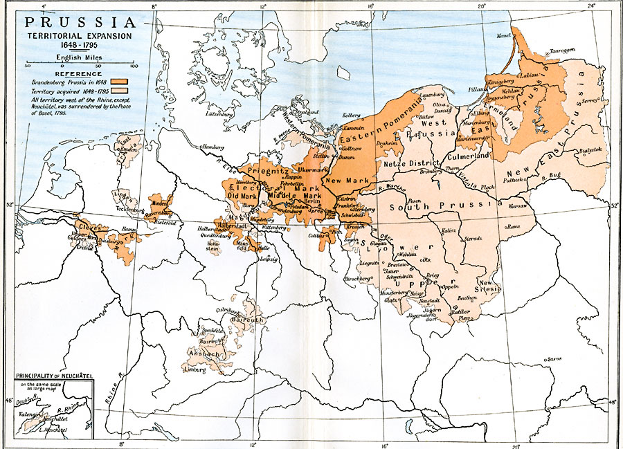
Description: A map of Prussian territorial expansion from the Treaty of Westphalia in 1648 to the Third Partition of Poland in 1795. The map is color–coded to show the Brandenburg Prussia of 1648, which included Cleves, Minden–Ravensberg, Halberstadt, Priegnitz, Electoral Mark, Eastern Pomerania, and East Prussia, and the territories acquired between 1648 and 1795, including East Frisia, Lingen, Ansbach, Baireuth, Magdeburg, West Prussia, South Prussia, Silesia, Ermeland, and New East Prussia. The map notes "All territory west of the Rhine, except Neuchâtel, was surrendered by the Peace of Basel, 1795." This map shows rivers and important cities, and includes an inset map of the Principality of Neuchâtel on the Rhine River.
Place Names: Central Europe, Anspach, �Berlin, �Frankfort, �Prussi
ISO Topic Categories: oceans,
location,
inlandWaters,
boundaries
Keywords: Prussia, political, �historical, local jurisdictions,
country borders, historical event,
other military, oceans,
location,
inlandWaters,
boundaries, Unknown, 1648–1795
Source: Ward, Prothero, and Leathes, The Cambridge Modern History Atlas (New York, NY: The Macmillan Company, 1912)
Map Credit: Courtesy the private collection of Roy Winkelman |
|