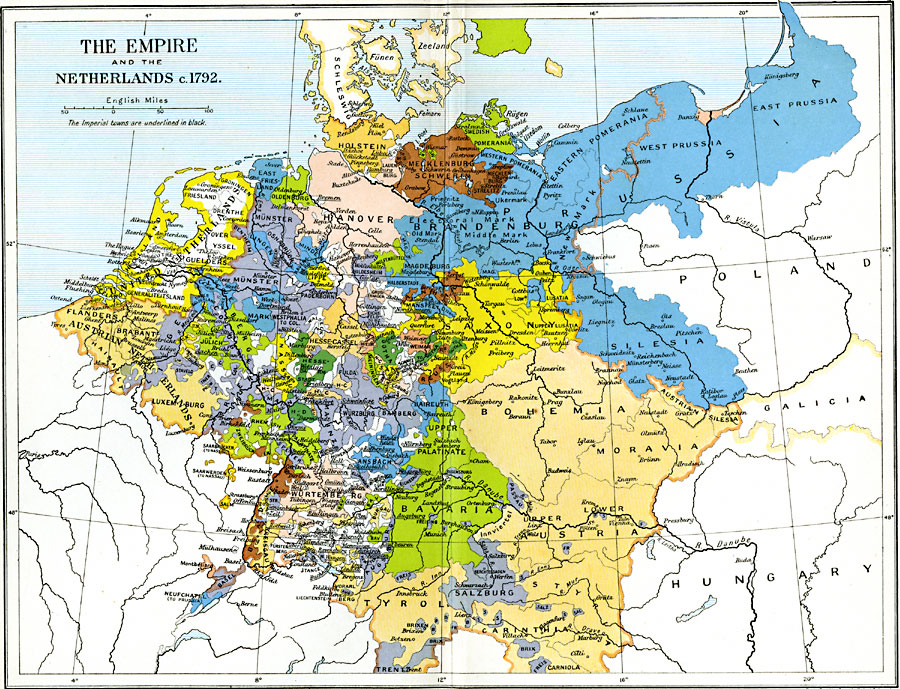
Description: A map of the Holy Roman Empire and the Netherlands at the time of the French Revolutionary Wars, just prior to the War of the First Coalition, Circa1792. The map is color–coded to show the German states, Brandenburg Prussia, the Austrian territories of Bohemia, Moravia, Styria, Carinthia, Carniola, and Tyrol, and the United Netherlands, and Austrian Netherlands. The map shows major cities and towns, with the names of Imperial cities (formally ruled by the Emperor rather than the local territory) underlined in black.
Place Names: Central Europe, Austria, �Bavaria, �Bohemia, �Brandenburg, �Hanover, �Mecklenburg, �Moravia, �Prussia, �Saxony, �Silesia, �Tyro
ISO Topic Categories: oceans,
location,
inlandWaters,
boundaries
Keywords: The Empire and the Netherlands, political, kFrenchRevolution, local jurisdictions,
country borders,
major political subdivisions, oceans,
location,
inlandWaters,
boundaries, Unknown, 1792
Source: Ward, Prothero, and Leathes, The Cambridge Modern History Atlas (New York, NY: The Macmillan Company, 1912)
Map Credit: Courtesy the private collection of Roy Winkelman |
|