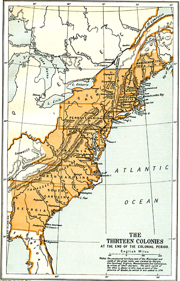
Description: A map of the British Thirteen Colonies at the end of the colonial period in 1774. The map shows the boundaries of the colonies and notes the uncolored territory east of the Mississippi and south of the Great Lakes as claimed by Georgia, the Carolinas, Virginia, Massachusetts and Connecticut, by virtue of their charters. The part north of the Ohio River is shown in this map as part of the province of Quebec, to which it was added in 1774 under the Quebec Act enacted by Parliament under King George of England.
Place Names: A Regional Map of North America, Canada, �United State
ISO Topic Categories: oceans,
location,
inlandWaters,
boundaries
Keywords: The Thirteen Colonies at the End of the Colonial Period, political, �historical, local jurisdictions,
country borders,
major political subdivisions, historical event, oceans,
location,
inlandWaters,
boundaries, Unknown, 1774
Source: Ward, Prothero, and Leathes, The Cambridge Modern History Atlas (New York, NY: The Macmillan Company, 1912)
Map Credit: Courtesy the private collection of Roy Winkelman |
|