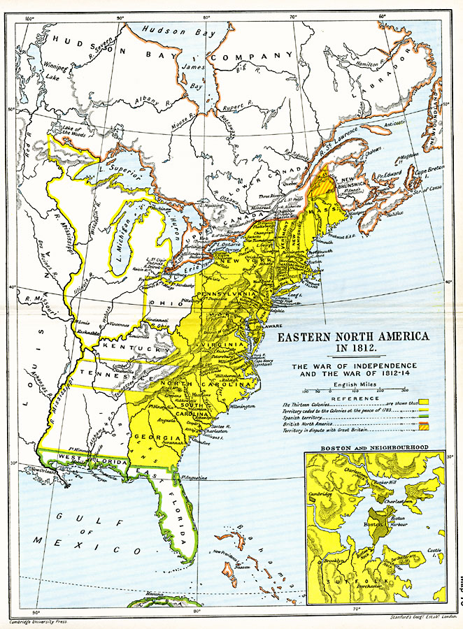
Description: A map of eastern North America in 1812 subtitled ‘The War of Independence and the War of 1812–1814.’ The map is color–coded to show the territories of the original thirteen colonies, the territory to the west that was ceded to the colonies at the peace of 1783, Spanish territories, British North America and Bahamas, and the disputed territory north of the Massachusetts Colony. The map shows cities, forts, and settlements, terrain, lakes, rivers, and coastal features. An inset map details the area around Boston and Boston Harbor, including the neighboring cities of Cambridge and Brooklyn.
Place Names: A Regional Map of North America, Bahamas, �Canada, �Connecticut, �Cuba, �Delaware, �Florida, �Georgia, �Louisiana, �Massachusetts, �New Hampshire, �New Jersey, �New York, �North America, �North Carolina, �Pennsylvania, �South Carolina, �Vermont, �Virgini
ISO Topic Categories: oceans,
location,
inlandWaters,
boundaries
Keywords: Eastern North America, political, local jurisdictions,
country borders,
major political subdivisions, oceans,
location,
inlandWaters,
boundaries, Unknown, 1812
Source: Ward, Prothero, and Leathes, The Cambridge Modern History Atlas (New York, NY: The Macmillan Company, 1912)
Map Credit: Courtesy the private collection of Roy Winkelman |
|