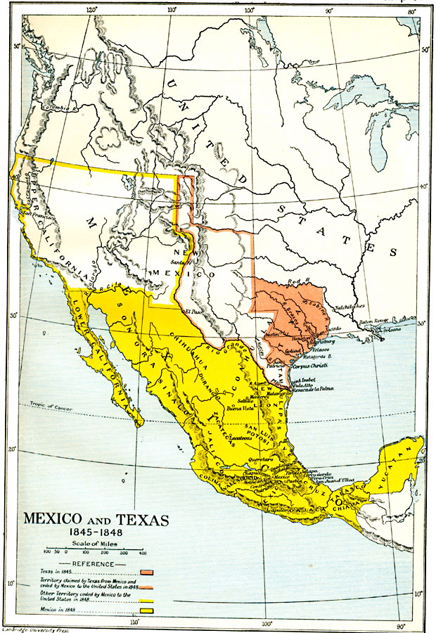
Description: A map of Mexico and Texas from the annexation of the Republic of Texas by the United States (1845) to the end of the Mexican–American War (1848). The map is color–coded to show the territory of Texas in 1845, the territory of dispute claimed by Mexico and the Republic of Texas and ceded to the United States in 1848, the northern territories (Upper California and New Mexico) ceded to the United States in 1848, and Mexico as established by the Treaty of Guadalupe Hidalgo at the end of the war. The map shows several important battle sites of the war.
Place Names: A Regional Map of North America, Chihuahua, �Durango, �Mexico, �Sinaloa, �Texas, �United States, �Yucata
ISO Topic Categories: oceans,
location,
inlandWaters,
boundaries
Keywords: Mexico and Texas, political, local jurisdictions,
country borders,
major political subdivisions, oceans,
location,
inlandWaters,
boundaries, Unknown, 1845–1848
Source: Ward, Prothero, and Leathes, The Cambridge Modern History Atlas (New York, NY: The Macmillan Company, 1912)
Map Credit: Courtesy the private collection of Roy Winkelman |
|