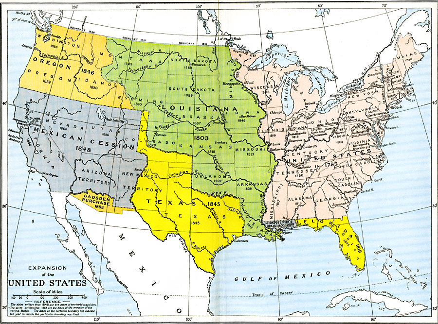
Description: A map from 1912 of the United States showing the territorial acquisitions up to the Gadsden Purchase in northern Mexico in 1853. The map is color–coded to show the territory of the original United States and the Northwest Territory defined by the Treaty of 1783, the Louisiana Purchase (1803), Florida purchased from Spain in 1819, the annexation of Texas in 1845, the Oregon Country in 1846, the Mexican cession of western lands in 1848, and the Gadsden Purchase in 1853. The map also notes the dates when the northern border with British Canada was fixed.
Place Names: Growth of Nation, Florida, �Louisiana, �Oregon, �Texas, �United States, �Louisiana Purchase, �Mexican Cession, �Gadsden Purchase, �Oregon Country, �Original Colonies, �West Florida, �East Florid
ISO Topic Categories: oceans,
location,
inlandWaters,
boundaries
Keywords: Expansion of the United States, political, �historical, local jurisdictions,
country borders,
major political subdivisions, historical event, oceans,
location,
inlandWaters,
boundaries, Unknown, 1783–1853
Source: Ward, Prothero, and Leathes, The Cambridge Modern History Atlas (New York, NY: The Macmillan Company, 1912)
Map Credit: Courtesy the private collection of Roy Winkelman |
|