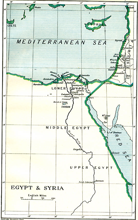
Description: A map of Egypt showing the major cities of the Nile Delta and the Nile River south to Assouan at the First Cataract in Upper Egypt. This map also includes the island of Cyprus, and cities along the Syrian coastline from Beyrout (Beirut), to El Arish on the Sinai Peninsula. The map shows many of the sites of Napoleon's invasion of Egypt and Syrian campaign against the Ottoman Turks.
Place Names: Egypt, Beirut, �Cairo, �Cyprus, �Egypt, �Fayoum, �Jerusalem, �Lebanon, �Palestine, �Suez, �Syria, �Beyrout, Acre, Haifa, Jaffa, Ramleh, Gaza, El Arish, Abukir, Rosetta, Alexandria, Ghizeh, Heliopolis, Girgeh, Aswan, Assouan
ISO Topic Categories: oceans,
location,
inlandWaters,
boundaries
Keywords: Egypt and Syria, political, kNapoleonBonaparte, country borders,
major political subdivisions,
local jurisdictions, oceans,
location,
inlandWaters,
boundaries, Unknown, 1912
Source: Ward, Prothero, and Leathes, The Cambridge Modern History Atlas (New York, NY: The Macmillan Company, 1912)
Map Credit: Courtesy the private collection of Roy Winkelman |
|