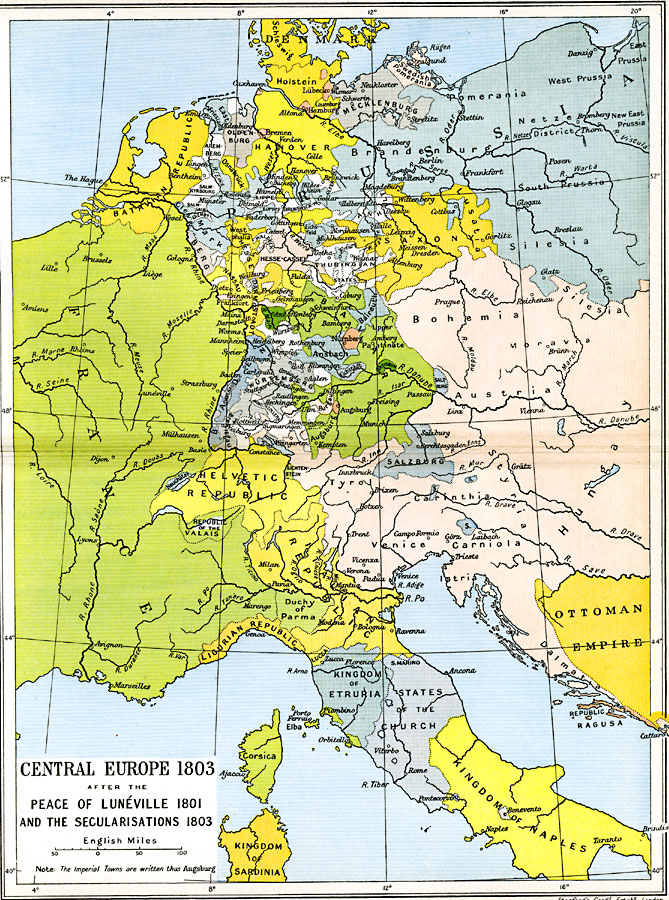
Description: A map of Central Europe in 1803, after the peace of Lunevlle in 1801 between the French Republic and the Holy Roman Empire, and the Secularizations of 1803 by Bonaparte and Talleyrand. This is the Europe just prior to the outbreak of the Napoleonic Wars in 1803. Map is color–coded to show various groups control over area. The map includes Denmark with Schleswig and Holstein, Swedish Pomerania, Mecklenburg, Hanover, Oldenburg, Aremberg, the Prussian states of East Friesland, Brandenburg, and Silesia, Saxony, Westphalia, Batavian Republic, Bavaria, Wü&rtemburg, Bohemia, Salzburg, Helvetic Republic, Neuchatel, Republic of the Valais, Italian Republic, Ligurian Republic, Lucca, Kingdom of Etruria, States of the Church, Corsica, Kingdom of Sardinia, Kingdom of Naples, and portions of France and the Ottoman Empire in Europe.
Place Names: Western and Central Europe, Austria, �Bavaria, �Bohemia, �Brandenburg, �Corsica, �France, �Hanover, �Hungary, �Naples, �Prussia, �Salzburg, �Saxony, �Venic
ISO Topic Categories: oceans,
location,
inlandWaters,
boundaries
Keywords: Central Europe after the Peace of Luneville and the Secularisations, political, �historical, kNapoleonBonaparte, kNapoleonicWars, country borders,
major political subdivisions,
local jurisdictions, other military, oceans,
location,
inlandWaters,
boundaries, Unknown, 1803
Source: Ward, Prothero, and Leathes, The Cambridge Modern History Atlas (New York, NY: The Macmillan Company, 1912)
Map Credit: Courtesy the private collection of Roy Winkelman |
|
