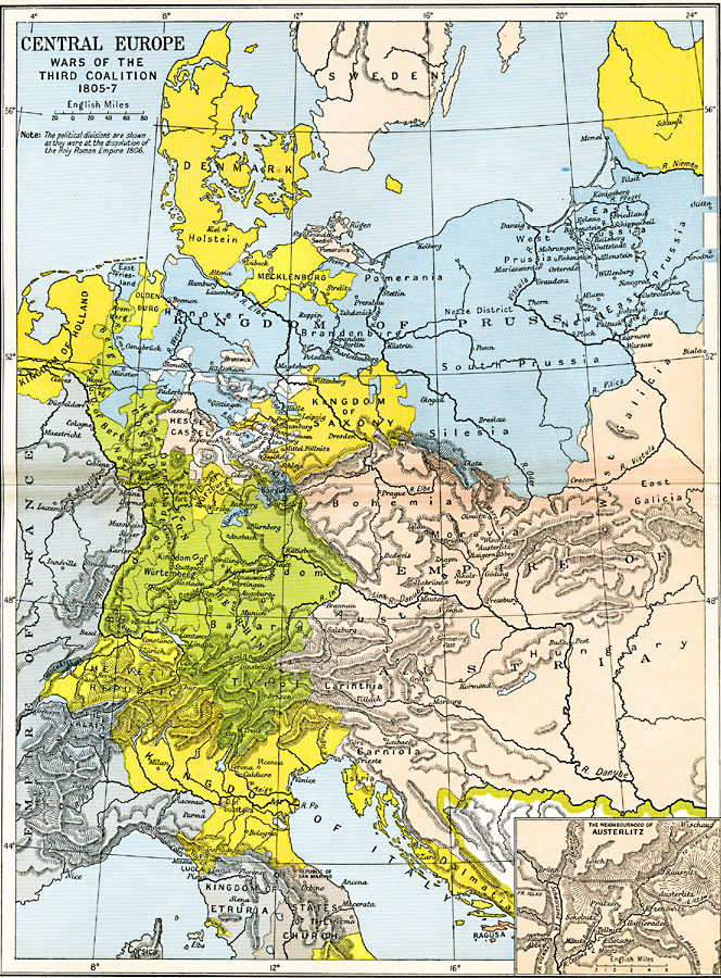
Description: A map showing Central Europe during the Napoleonic Wars, subtitled "Wars of the Third Coalition 1805–1807." The political boundaries reflect the dissolution of the Holy Roman Empire in 1806. Map is color–coded to show various group's control over area, including Denmark, Swedish Pomerania, Mecklenburg, Kingdom of Prussia, Oldenburg, Kingdom of Holland, Hesse–Cassel, Wüertemburg, Kingdom of Saxony, Empire of Austria, Confederation of the Rhine, Helvetic Republic, Neuchatel, Kingdom of Italy, Kingdom of Etruria, States of the Church, and portions of the Empire of France. The inset map details the neighborhood of Austerlitz, site of Napoleon's defeat of the Third Coalition against the French Empire.
Place Names: Western and Central Europe, Austria, �Bavaria, �Denmark, �France, �Helvetic Republic, �Holland, �Mecklenburg, �Prussia, �Saxony, �Sweden, �Tuscany, �Tyro
ISO Topic Categories: oceans,
location,
inlandWaters,
boundaries
Keywords: Central Europe during the Wars of the Third Coalition, political, �historical, kNapoleonBonaparte, kNapoleonicWars, country borders,
major political subdivisions,
local jurisdictions, historical event,
other military, oceans,
location,
inlandWaters,
boundaries, Unknown, 1805–1807
Source: Ward, Prothero, and Leathes, The Cambridge Modern History Atlas (New York, NY: The Macmillan Company, 1912)
Map Credit: Courtesy the private collection of Roy Winkelman |
|