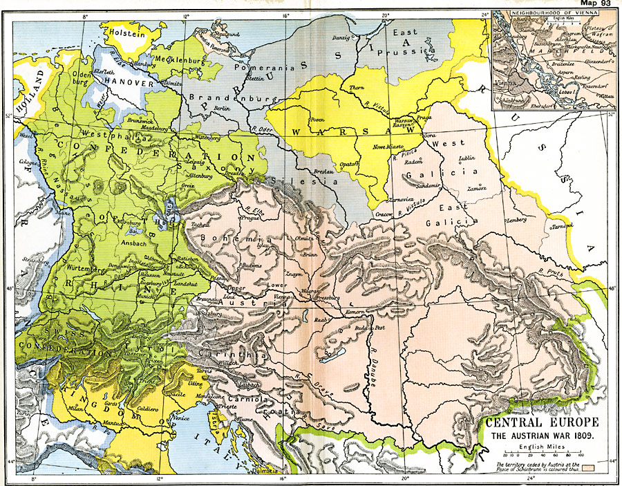
Description: A map showing Central Europe during the War of the Fifth Coalition, subtitled "The Austrian War 1809." The Austrian War was between the coalition of the Austrian Empire and the United Kingdom against Napoleon Bonaparte's French Empire, and resulted in a French victory. The map is color–coded to show the established boundaries of the Central European countries at the time, and the lands ceded by Austria at the Peace of Schönbrunn. Countries shown include Holland, Danish Holstein, Hanover, Swedish Pomerania, Prussia, Warsaw, the Confederation of the Rhine, which included the Swiss Confederation, and portions of France, the Kingdom of Italy, and all of the former Austrian Empire. The inset map details the environs of Vienna and nearby Schönbrunn Palace, site of the signing of the treaty between France and Austria.
Place Names: Central Europe, Austria, �Bohemia, �Denmark, �France, �Galicia, �Helvetic Republic, �Holland, �Mecklenburg, �Prussia, �Rhine, �Saxony, �Tyrol, �Warsaw, �Westphali
ISO Topic Categories: oceans,
location,
inlandWaters,
boundaries
Keywords: Central Europe and the Austrian War, political, �historical, kNapoleonBonaparte, kNapoleonicWars, country borders,
major political subdivisions,
local jurisdictions, historical event,
other military, oceans,
location,
inlandWaters,
boundaries, Unknown, 1809
Source: Ward, Prothero, and Leathes, The Cambridge Modern History Atlas (New York, NY: The Macmillan Company, 1912)
Map Credit: Courtesy the private collection of Roy Winkelman |
|