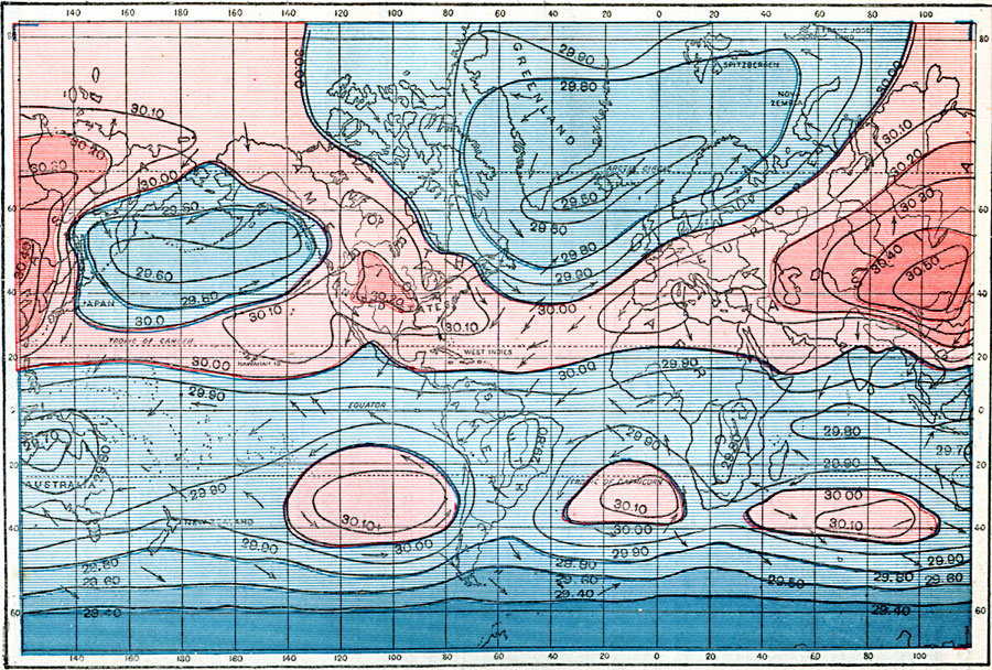
Description: A world map from 1896 showing typical global isobars and winds during January. This map is color–coded to show the areas of high barometric pressure in pinks, and areas of low barometric pressure in blues. Barometric pressures are shown on the isobar lines. Typical wind directions are shown flying with the arrowheads, away from high pressure and towards low pressure areas.
Place Names: A Complete Map of Globes and Multi-continent, Africa, �Antarctica, �Asia, �Australia, �Europe, �North America, �South Americ
ISO Topic Categories: climatologyMeteorologyAtmosphere,
inlandWaters,
location,
oceans
Keywords: January Isobars, physical, �meteorological, �air pressure, kClimate, physical features, climatologyMeteorologyAtmosphere,
inlandWaters,
location,
oceans, Unknown, 1896
Source: Frank Waldo, Elementary Meteorology (New York, New York: American Book Company, 1896) 91
Map Credit: Courtesy the private collection of Roy Winkelman |
|