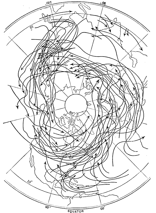
Description: A map from 1896 of the northern hemisphere showing the typical paths of cyclones in the hemisphere. This map "shows the paths pursued by a great many individual cyclones. The arrow–headed curved lines show at their beginning the place of formation, their length shows the path pursued, and the points of the arrows show the direction of motion and place of dissipation of individual cyclones." &mdash Waldo, 1896, p. 225.
Place Names: Northern Hemisphere, Asia, �Europe, �North Americ
ISO Topic Categories: oceans,
climatologyMeteorologyAtmosphere
Keywords: Typical Paths of Cyclones in the Northern Hemisphere, physical, �meteorological, �storm paths, cyclones, hurricanes, tropical storms, kClimate, physical features, oceans,
climatologyMeteorologyAtmosphere, Unknown, 1896
Source: Frank Waldo, Elementary Meteorology (New York, New York: American Book Company, 1896) 224
Map Credit: Courtesy the private collection of Roy Winkelman |
|