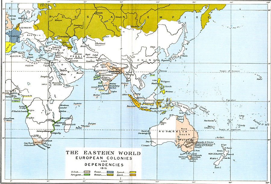
Description: A map showing much of the Eastern Hemisphere, subtitled "European Colonies and Dependencies 1815." This map is color–coded to show colonies and lands controlled by European powers in Africa, India, Indonesia, and Australia at the time, including the British (pink), French (purple), Spanish (yellow), Portuguese (green), Russian Empire (gold), and Dutch (orange).
Place Names: Regional Miscellaneous, Asia, �Astrakhan, �Australia, �Africa, �Bengal, �Celebes, �Europe, �France, �Java, �Netherlands, �Philippines, �Russia, �Spain, �Sumatra, �Wale
ISO Topic Categories: political, kWorldIndian, kWorldPacific, kWorldEurasia, kWorldAfroAsia
Keywords: The Eastern World, political, country borders,
local jurisdictions,
major political subdivisions, political, kWorldIndian, kWorldPacific, kWorldEurasia, kWorldAfroAsia, Unknown, 1815
Source: Ward, Prothero, and Leathes, The Cambridge Modern History Atlas (New York, NY: The Macmillan Company, 1912)
Map Credit: Courtesy the private collection of Roy Winkelman |
|