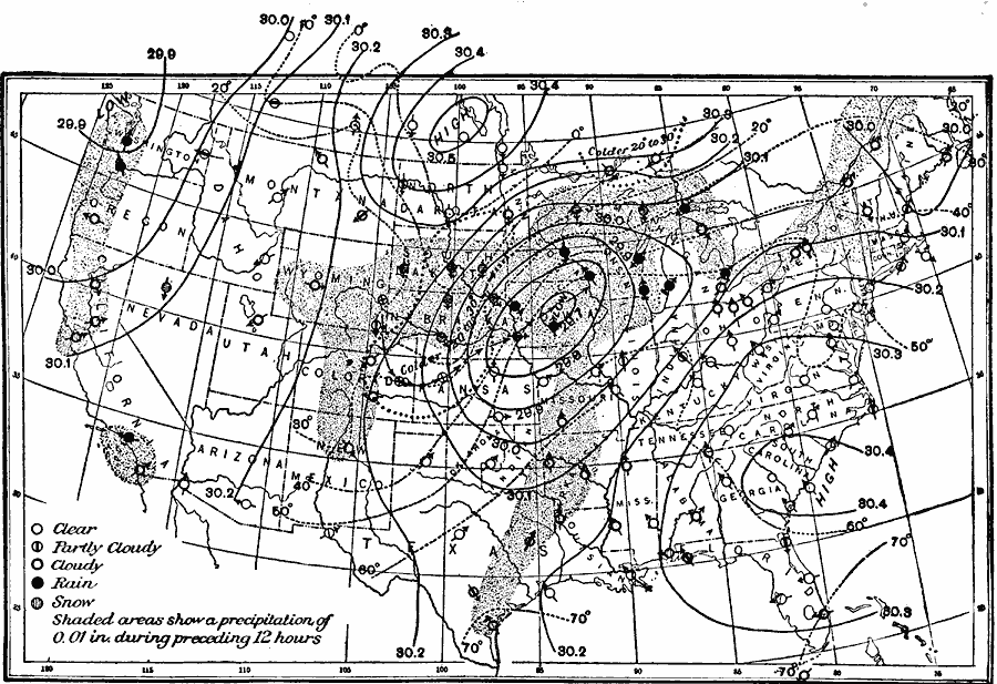
Description: A sample United States weather map for 8 P.M., December 24, 1893, showing typical symbols found on winter weather maps at the time, including symbols for clear weather, partly cloudy, cloudy, rain, and snow, wind arrows showing prevailing wind direction, isobar lines, and shading representing precipitation during the preceding 12 hours.
Place Names: Meteorology, rainfall, �cloud coverage, �sno
ISO Topic Categories: climatologyMeteorologyAtmosphere,
inlandWaters,
oceans,
location
Keywords: United States Weather, physical, �political, �meteorological, kClimate, physical features, country borders,
major political subdivisions, climate,
rainfall, climatologyMeteorologyAtmosphere,
inlandWaters,
oceans,
location, Unknown, December 24, 1893
Source: Frank Waldo, Elementary Meteorology (New York, NY: American Book Company, 1896) 281
Map Credit: Courtesy the private collection of Roy Winkelman |
|