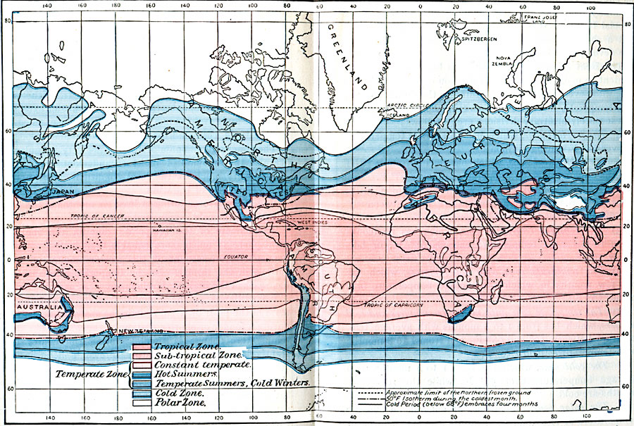
Description: A world map from 1896 showing the heat zones of the Earth, according to the duration of the hot, temperate, and cold periods. The map is color–coded to show the Tropical Zone, Sub–tropical Zone, Temperate Zone (including zones of constant temperature, hot summers, and zones of temperate summers and cold winters), Cold Zone, and Polar Zone. Boundary lines show the approximate limit of the Northern frozen ground, the 50° Fahrenheit isotherm during the coldest month, and the area where the cold period (below 68° Fahrenheit) embraces four months of the year.
Place Names: A Complete Map of Globes and Multi-continent, Antarctica, �Africa, �Asia, �Australia, �Europe, �North America, �South Americ
ISO Topic Categories: climatologyMeteorologyAtmosphere,
inlandWaters,
location,
oceans
Keywords: Global Heat Zones, physical, �meteorological, kClimate, physical features, temperature,
climate, climatologyMeteorologyAtmosphere,
inlandWaters,
location,
oceans, Unknown, 1896
Source: Frank Waldo, Elementary Meteorology (New York, New York: American Book Company, 1896) 304-305
Map Credit: Courtesy the private collection of Roy Winkelman |
|