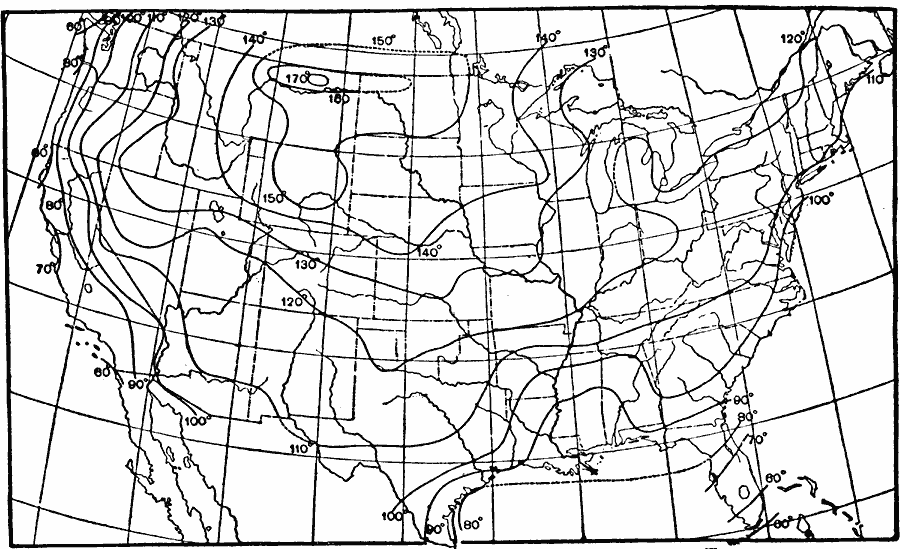
Description: A map from 1896 showing the mean absolute amplitude of the oscillation of shade temperature in the United States. "Temperature observations of the air should be made in the shade, and at about six to ten feet above grass–covered earth." — Waldo, 1896, p. 34.
Place Names: Meteorology, temperatur
ISO Topic Categories: climatologyMeteorologyAtmosphere,
inlandWaters,
oceans
Keywords: Shade Temperature Oscillation, physical, �meteorological, kClimate, physical features, temperature, climatologyMeteorologyAtmosphere,
inlandWaters,
oceans, Unknown, 1896
Source: Frank Waldo, Elementary Meteorology (New York, NY: American Book Company, 1896) 329
Map Credit: Courtesy the private collection of Roy Winkelman |
|
