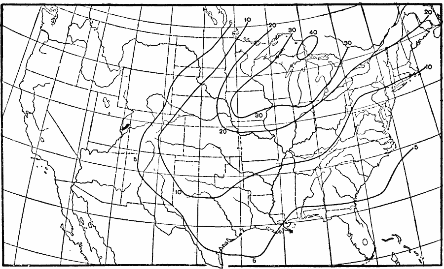
Description: A map from 1896 of the United States showing the relative frequency of drastic falls of temperature (over 20 degrees) in 24 hours.
Place Names: Meteorology, temperatur
ISO Topic Categories: climatologyMeteorologyAtmosphere,
inlandWaters,
oceans
Keywords: Drastic Temperature Drops, physical, �meteorological, kClimate, physical features, temperature, climatologyMeteorologyAtmosphere,
inlandWaters,
oceans, Unknown, 1896
Source: Frank Waldo, Elementary Meteorology (New York, NY: American Book Company, 1896) 333
Map Credit: Courtesy the private collection of Roy Winkelman |
|