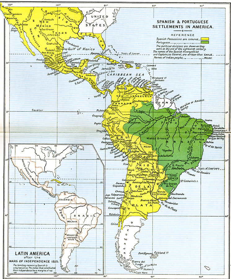
Description: A map of South America, Central America, West Indies, and southern North America showing the Spanish and Portuguese possessions and settlements in the Americas at the end of the eighteenth century. The map is color-coded to show Spanish possessions in the region in yellow and Portuguese possessions in green. The Spanish possessions shown include California, New Mexico, Louisiana, Florida, Texas, New Spain, Cuba, Santo Domingo, Porto Rico, Guatemala, New Venezuela, Granada, Peru, Chile, and Rio de la Plata. The Portuguese possessions include the districts of Gran Plata, Piauhi, Maranhao, Matto Grosso, Parahiba, Pernambuco, Bahia, Sao Palo, Santa Catharina, and Rio Grande do Sul in Brazil. The names of Indian peoples are given. An inset map shows the region in 1825 after the Wars of Independence with the territories remaining under Spanish control colored yellow (Cuba and Puerto Rico), and the states that established their independence outlined in pink. The new Latin American states include the United States of Mexico, Columbia, Bolivia, Paraguay, Uruguay, and the Argentine Confederation.
Place Names: Regional Americas, Brazil, �Chile, �Granada, �Guatemala, �North America, �Peru, �South America, �Venezuel
ISO Topic Categories: political, �historical, kWorldAmericas
Keywords: Spanish and Portuguese Settlements in America, political, �historical, country borders,
local jurisdictions,
major political subdivisions, historical event, political, �historical, kWorldAmericas, Unknown, 1792–1870
Source: Ward, Prothero, and Leathes, The Cambridge Modern History Atlas (New York, NY: The Macmillan Company, 1912)
Map Credit: Courtesy the private collection of Roy Winkelman |
|